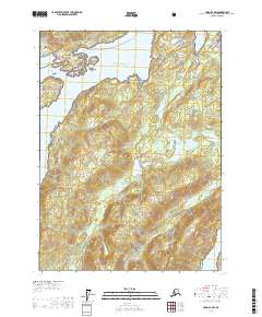
USGS Topo Quad Craig B-2 NW, Alaska
Download Craig B-2 NW
Download Craig B-2 NW
Southern Latitude:
55.3750 N
Eastern Longitude:
-132.5000
Northen Latitude:
55.5000 N
Western Longitude:
-132.6667
Bay(s) in Craig B-2 NW
Clark Bay,
Hollis Anchorage,
Twelvemile Arm,
Twelvemile Bay,
Cape(s) in Craig B-2 NW
Althouse Point,
Island(s) in Craig B-2 NW
Cat Island,
Loy Island,
Lake(s) in Craig B-2 NW
Kina Lake,
Lake Mary,
Old Franks Lake,
Stream(s) in Craig B-2 NW
Halfmile Creek,
Kina Creek,
Maybeso Creek,
